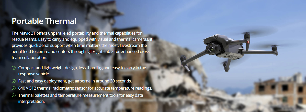
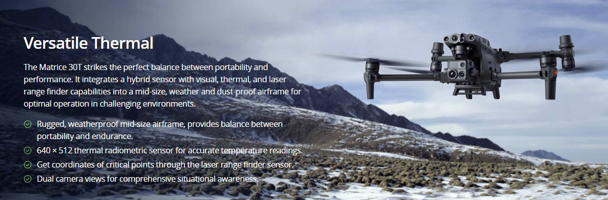
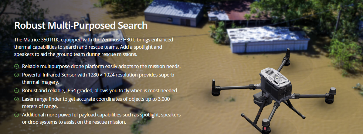
Search and Rescue

Swiftly aid search and rescue missions by covering extensive and difficult-to-navigate landscapes, utilizing aerial thermal imaging to pinpoint the whereabouts of lost individuals.

Painpoints

  • Rescue missions often occur on vast and challenging terrains, which can limit ground search capabilities.
  • Lack of accurate coordinates and visual references can negatively impact response missions.
  • Certain terrains and conditions pose challenges to easily identifying a missing person through visual ground searches.

Advantages

  • Cover large areas more efficiently with drone-based search missions.
  • Provide accurate coordinates and visual references to ground teams for more efficient rescue missions.
  • Overcome terrain and visibility challenges with aerial searches that detect heat patterns.

Solution

Portable Thermal

Drone Platform

DJI Mavic 3T
Weight: 920 g
Max Flight Time (no wind): 45 mins
Sensing type: Omnidirectional binocular vision system, supplemented with an infrared sensor at the bottom of the aircraft
Environment Adapbility: Max Take-off Altitude Above Sea Level 6000m; Max Wind Speed Resistance 12 m/s
Wide Camera: 1/2-inch CMOS, Effective pixels: 48 MP
Tele Camera: 1/2-inch CMOS, Effective pixels: 12 MP
Thermal Camera: Video Resolution 640×512@30Hz
Compatible with RTK module and DJI Cellular module

Payload And Software

DJI Pilot 2
Ground control
DJI FlightHub 2
Drone and dock’s cloud management system

Workflow

Mission Execution:

    1. – Fly manually over the last known location following a search pattern such as the wheel route.
    1. – Draw points, lines, or polygons on a map on DJI FlightHub 2 to mirror the last known location, trails, or key areas of interest.
    1. – Select a suitable infrared palette and gain mode for the conditions at hand. White Hot and Black Hot palettes are preferred.
    1. – Switch between infrared and visual cameras. Use the Link Zoom feature to zoom in simultaneously with thermal and visual sensors.
    1. – As the situation allows, generate a rapid 2D map on DJI FlightHub 2 to provide a better understanding of search area and routes.
    1. – Once the subject is identified, mark the location with the drone flying over.
    1. – Communicate with the rescuee and rescue teams using the speaker if applicable.
    – Support team on the rescue mission providing lighting from the drone using the spotlight.
Versatile Thermal

Drone Platform

Matrice 30T
Weight (incl. two batteries): 3770 ± 10 g.
Max Flight Time: 41 min.
Sensing system: Six-directional sensing and positioning.
Environment Adaptability: Max Service Ceiling Above Sea Level (without other payload) 7,000 m (with 1676 propellers); Max Wind Resistance 12 m/s.
Zoom camera: 1/2 CMOS, Effective pixels: 48M.

Payload And Software

DJI Pilot 2
Ground control
DJI FlightHub 2
Drone and dock’s cloud management system

Workflow

Mission Execution:

    1. – Fly manually over the last known location following a search pattern such as the wheel route.
    1. – Draw points, lines, or polygons on a map on DJI FlightHub 2 to mirror the last known location, trails, or key areas of interest.
    1. – Select a suitable infrared palette and gain mode for the conditions at hand. White Hot and Black Hot palettes are preferred.
    1. – Switch between infrared and visual cameras. Use the Link Zoom feature to zoom in simultaneously with thermal and visual sensors.
    1. – For night missions, operators can choose to disable the IR Cut Filter of the zoom camera for enhanced night visibility.
    1. – As the situation allows, generate a rapid 2D map on DJI FlightHub 2 to provide a better understanding of search area and routes.
    1. – Once the subject is identified. Get the coordinates of subject using the laser range finder and the Pin Point function or draw out routes and areas to avoid.
    1. – Share Pin Point coordinates to ground teams through DJI Pilots 2 QR code or DJI FlightHub 2.
    1. – Communicate with the rescuee and rescue teams using the speaker if applicable.
    – Support team on the rescue mission providing lighting from the drone using the spotlight.

Contact us

If you wish to purchase products, please leave your contact information below. We will be in contact with you shortly.