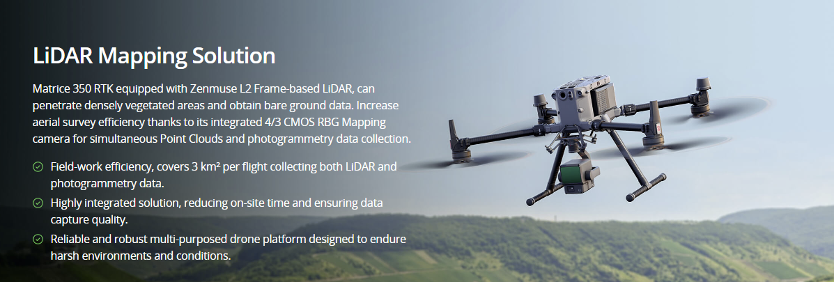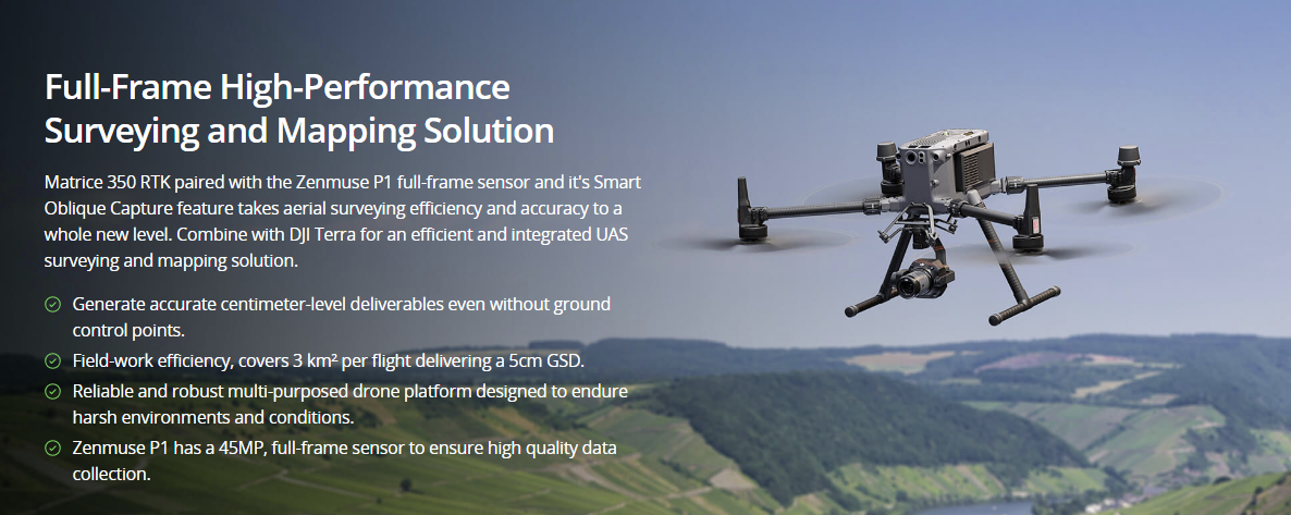
Painpoints
- Cadastral surveys usually require collecting large data sets, including data gathered by ground teams in hazardous or inaccessible areas.
-
Traditional cadastral survey methods lack visual data, limiting adequate land-use analysis.
Boost the efficiency of land administration and cadastral processes by using high-accuracy UAS solutions to quickly generate digital models.
If you wish to purchase products, please leave your contact information below. We will be in contact with you shortly.