Additional Response

Diversify your response scope for Hazmat, water rescue, and other unexpected emergencies with multipurpose aerial support.

Painpoints

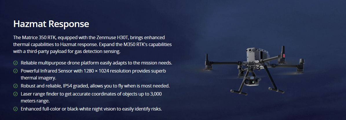
  • Firefighters often find themselves short-handed and unequipped to properly evaluate the risks in the event of a hazardous material leakage.
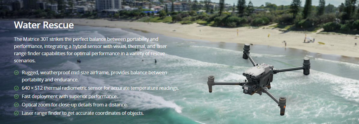
  • Water rescue scenarios are often coordinated by land-based teams with limited resources and information.
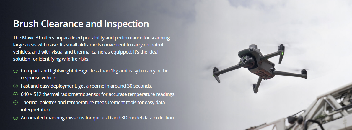
  • Fire prevention efforts usually require extensive manual labor, with teams going on foot scouting for potential fire risks.

Advantages

  • Improve response efficiency with valuable situational awareness and quality data.
  • Gain rapid aerial perspectives and real-time monitoring, enhancing the effectiveness of water rescue missions.
  • Cover large areas, make informed decisions, and allocate resources effectively with accurate aerial data.

Solution

Hazmat Response

Drone Platform

Matrice 350 RTK
Weight: Approx. 6.47 kg(with single downward gimbal and two TB65 batteries).
Max Flight Time: 55 minutes.
Sensing system: Six-directional sensing and positioning.
Environment Adaptability: IP55, Max Service Ceiling Above Sea Level 7,000 m (with 1676 propellers, without other payload); Max Wind Resistance 12 m/s.

Payload And Software

Zenmuse H30T
Weight: 920±5 g.
Ingress Protection Rating: IP54.
Zoom Camera: 1/1.8-inch CMOS, Effective Pixels: 40 MP.
Wide-Angle Camera: 1/1.3-inch CMOS, Effective Pixels: 48 MP.
Infrared Thermal Camera: 1280×1024@30fps.
Laser Range Finder: max range 3000 m.

Workflow

  1. Mission Execution:
    – Fly manually over the affected area to determine the severity of the situation. Switch between infrared and visual views to evaluate the situation.
    – Use the Link Zoom feature to zoom in simultaneously with thermal and visual sensors.
    – Install the IR Density Filter to increase the measurement range of the thermal sensor.
    – Share the coordinates with ground teams through the DJI Pilot 2 QR code or DJI FlightHub 2.
  2. Post Mission Documentation:
    – Collect the videos and photos captured during the mission through DJI FlightHub 2 or download from the payload SD card to be used as supporting documentation for post-disaster analysis.
Water Rescue

Drone Platform

Matrice 30T
Weight (incl. two batteries): 3770 ± 10 g.
Max Flight Time: 41 min.
Sensing system: Six-directional sensing and positioning.
Environment Adaptability: Max Service Ceiling Above Sea Level (without other payload) 7,000 m (with 1676 propellers); Max Wind Resistance 12 m/s.
Zoom camera: 1/2 CMOS, Effective pixels: 48M.

Payload And Software

DJI Pilot 2
Ground control


DJI FlightHub 2
Drone and dock’s cloud management system

Workflow

  1. Mission Execution:
    – Using DJI Pilot 2 app, add the last known location to the map as a GPS Pin.
    – In the DJI Pilot 2 camera view, use the AR of the pin to fly directly toward the correct coordinates.
    – Fly manually over search areas switching between visual and thermal views to identify the missing person.
    – Utilize white hot or black hot palettes as needed along with high gain mode.
    – Once the subject is identified. Get accurate coordinates using the Pin Point function. Share Pin Point coordinates to ground teams through DJI Pilots 2 QR code or DJI FlightHub 2.
  2. Post Mission Documentation:
    – Collect the videos and photos captured during the mission through DJI FlightHub 2 or download from the drone SD card to be used as supporting documentation for post-disaster analysis.
Brush Clearance and Inspection

Drone Platform

DJI Mavic 3T
Weight: 920 g
Max Flight Time (no wind): 45 mins
Sensing type: Omnidirectional binocular vision system, supplemented with an infrared sensor at the bottom of the aircraft
Environment Adapbility: Max Take-off Altitude Above Sea Level 6000m; Max Wind Speed Resistance 12 m/s
Wide Camera: 1/2-inch CMOS, Effective pixels: 48 MP
Tele Camera: 1/2-inch CMOS, Effective pixels: 12 MP
Thermal Camera: Video Resolution 640×512@30Hz
Compatible with RTK module and DJI Cellular module

Payload And Software

DJI Pilot 2
Ground control

DJI Terra
Modeling and flight mission plan
Learn more

DJI FlightHub 2
Drone and dock’s cloud management system
Learn more

Workflow

  1. Mission Execution:
    – Plan a 2D or Smart Oblique Mission based on the actual landscape situation to generate regular orthomosaic images or 3D Models.
    – Fly manually over the affected area looking for hotspots. Switch between infrared and visual views (wide or zoom) to evaluate the infrastructure and vegetation.
  2. Post Mission Documentation:
    – Map the affected areas for post-incident reports and preventative action briefs.

Contact us

If you wish to purchase products, please leave your contact information below. We will be in contact with you shortly.